.jpg)
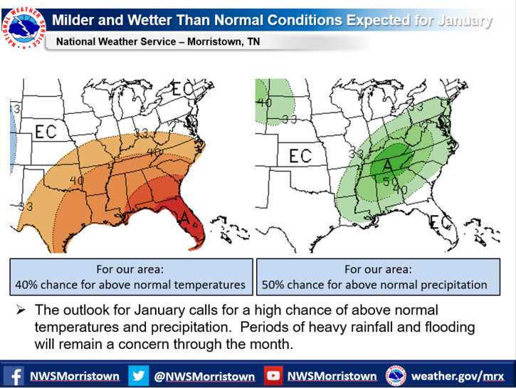
This graphic from the National Weather Service at Morristown offers a glimpse into our January weather.
LAFOLLETTE, TN (WLAF) – A strong storm system continues moving across the Tennessee Valley through today bringing periods of moderate to heavy rainfall that could lead to flooding as well as rises on area rivers. As a result, a Flood Watch continues for Campbell County and other portions of the area.
The Flood Watch runs through 6 pm Friday as total storm rainfall amounts of one to three inches are expected. This amount of rainfall is causing ponding on area roadways. Small rivers and streams could overflow their banks.
A Flood Watch means that conditions are favorable for heavy rain which may lead to flooding in and near the watch area. Be alert for rising water or water over roadways. Keep informed and be ready for action if flooding is observed or if a flood warning is issued. If you come to a closed or flooded road turn around! Don`t drown!
In addition, high winds will be possible in the mountains of East Tennessee. As the system exits the area, precipitation is expected to change to snow showers Saturday afternoon into Saturday night, beginning in the higher elevations and likely dropping into the valley as well. Some light accumulations will be possible in the mountains, Cumberland Plateau, and higher elevations of Southwest Virginia. (WLAF NEWS PUBLISHED – 01/03/2020-6AM)